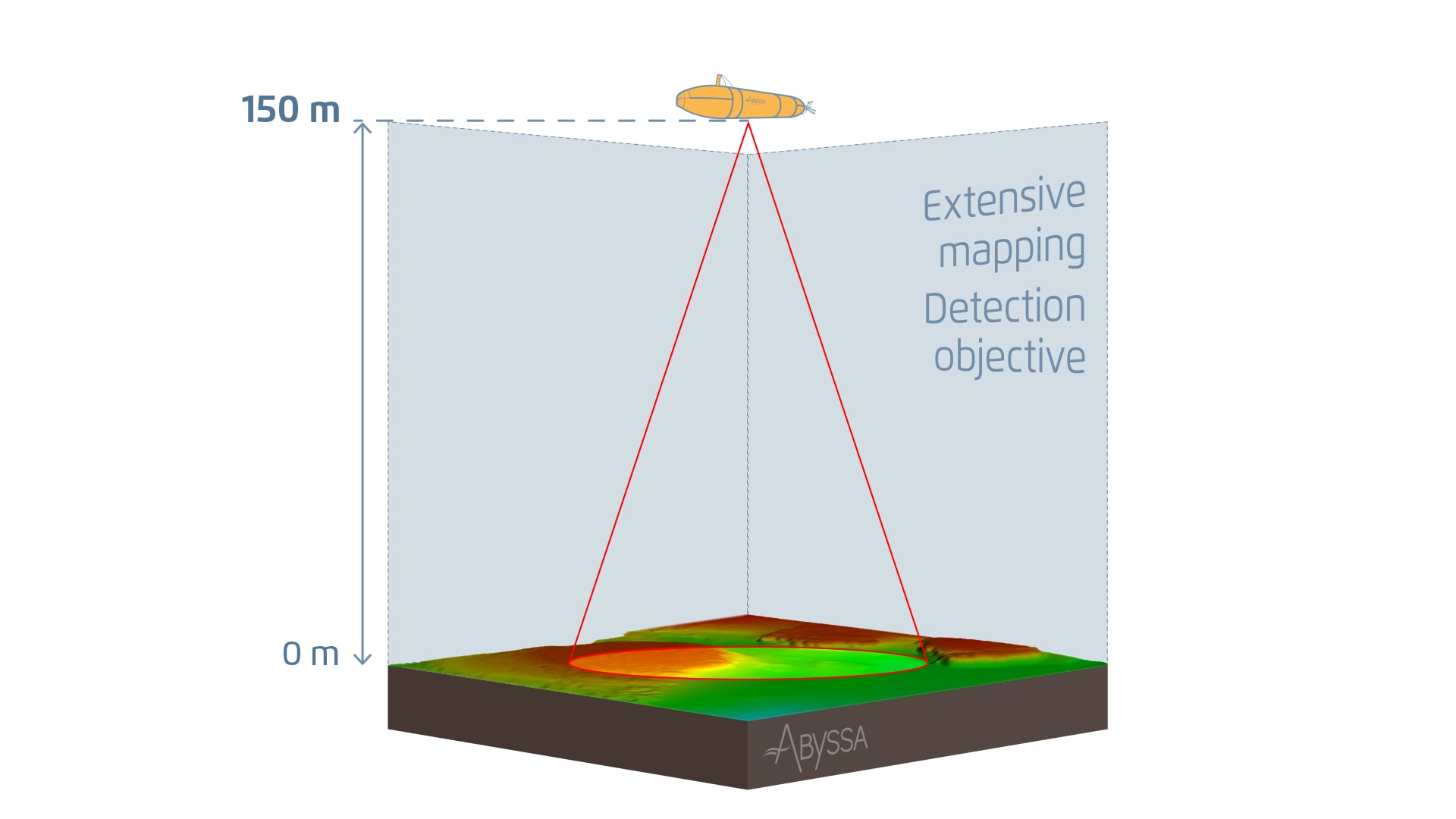
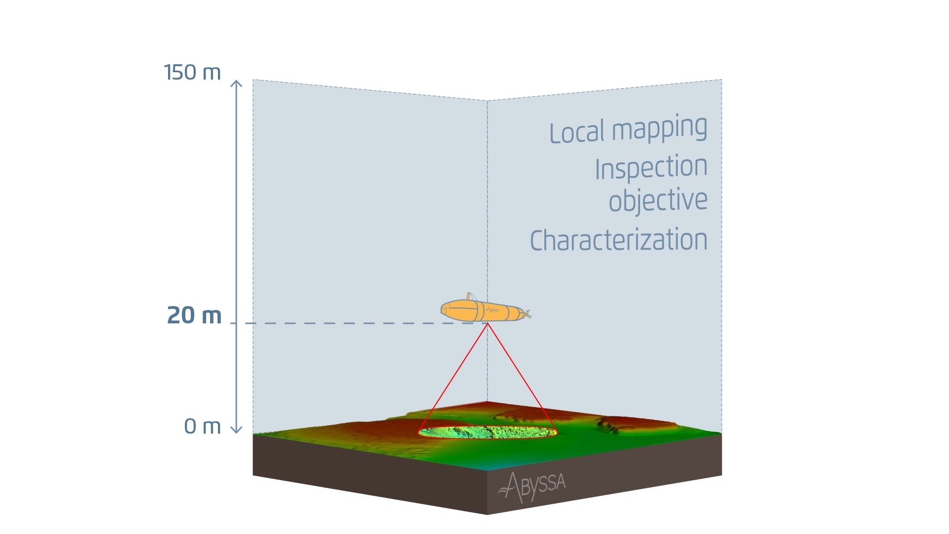
It would thus be possible to deploy a series of protocols in a single zone of interest, acquiring data at different altitudes, and thus propose multi-scale survey and mapping protocols suitable for drawing up regional detection and local characterisation charts.
Regional mapping and detecting small objects: a multi-scale approach
These different operating protocols, using a combination of probes, ‘flight’ plans and altitudes, provide views of the ocean floor and can also be useful when combined together.
Suppose you need a general bathymetric chart of the seabed.
We can propose an operating altitude of 100-150 m above the seabed, using a bathymetric multibeam echosounder to obtain a high-resolution bathymetric chart within a range of 2 to 3 m of the seabed.
Or perhaps you need to locate small objects on the seabed that measure just a few metres or even decimetres?
Then we can use our AUV’s at low altitude to obtain high resolution images. Profiling at 20 m, recording data using wide-swath acoustic sonar, can be used to detect objects, for example.
Or maybe you need optical images along the entire length of a cable or pipeline?
In that case, our AUVs can be operated at 5 m above the seabed to characterise the target in detail.
Prior to a campaign, we specify the survey protocol
Before sending out our AUVs to map, locate or survey an area, a key step entails accurately setting out the survey protocol: what measurements need to be taken? what is the ‘flight’ plan? at what altitude will measurements be taken?
All these different parameters on which operations at sea depend must be specified prior to the campaign, tailored to your needs and expectations and, naturally, to local constraints (the seabed relief, the currents, etc.).
All these different parameters on which operations at sea depend must be specified prior to the campaign, tailored to your needs and expectations and, naturally, to local constraints (the seabed relief, the currents, etc.).

